
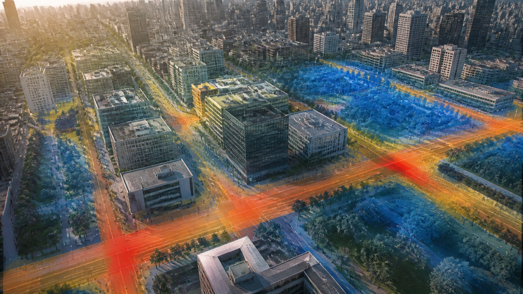
The era of climate-aware urban planning is here.
Cities are becoming hotter, denser, and more complex. Roads, rooftops, concrete, and closely packed buildings absorb solar energy during the day and release it slowly at night. As a result, urban areas can become 2–5°C warmer than surrounding rural areas, with even greater differences across specific streets, districts, and paved surfaces.
This is the urban heat island (UHI) effect: and it is no longer only an environmental concern. It is a public health, energy, infrastructure, and city-planning challenge.
In this use case, part of the series 50 Ways MetaWorldX Physical AI Is Transforming the World, we explore how the MetaWorldX Physical AI platform uses AI digital twin technology to help cities understand heat at street level, test interventions before construction, and make climate adaptation more measurable.
Urban heat is a system-wide risk
Urban heat does not affect every neighborhood equally. Dense districts with limited vegetation, dark roofs, wide roads, and low wind circulation often experience the highest temperatures.
The impacts extend across city operations:
- Public health: Extreme heat increases the risk of heat exhaustion, heat stroke, cardiovascular strain, and respiratory distress. Older adults, young children, outdoor workers, people with chronic conditions, and low-income residents are particularly vulnerable.
- Energy demand: Higher temperatures drive increased air-conditioning use, creating sharp peaks in electricity demand and putting additional pressure on the grid.
- Infrastructure stress: Heat can accelerate pavement deterioration, affect rail and road systems, increase cooling requirements for buildings, and reduce the operating margins of critical facilities.
- Reduced public-space comfort: Hot sidewalks, plazas, transit stops, and schoolyards become less usable during the periods when residents most need access to outdoor spaces.
- Unequal climate exposure: Neighborhoods with fewer trees and less investment can experience greater heat exposure and fewer opportunities for relief.
The U.S. Environmental Protection Agency notes that heat islands compound the effects of climate change, increasing heat-wave severity and associated health risks. In Canada, the Climate Atlas of Canada similarly highlights how paved surfaces, buildings, vehicles, and reduced vegetation intensify heat in urban environments.
The planning challenge is clear: cities need to move from observing heat to actively designing against it.
Why conventional heat mapping is not enough
Satellite imagery and occasional field surveys provide important information, but they offer only a partial view of urban heat.
A surface temperature map may identify a hot roof or parking lot. It may not explain:
- How heat moves between buildings and streets
- Whether a proposed tree canopy will shade a vulnerable pedestrian corridor
- How a green roof could affect a building’s cooling load
- Which cooling intervention delivers the greatest benefit per dollar
- How heat exposure changes during different times of day or weather conditions
- Whether a mitigation project could affect emergency access, maintenance, drainage, or surrounding infrastructure
Urban planners need more than a static map. They need a living, three-dimensional model that connects physical conditions with operational data, future scenarios, and policy decisions.
That is where MetaWorldX Physical AI adds value.
How MetaWorldX Physical AI analyzes urban heat
MetaWorldX creates a dynamic digital representation of the built environment. By combining 3D city models, IoT networks, environmental data, infrastructure information, and AI-powered analytics, the platform helps decision-makers understand how urban systems behave in real conditions.
For UHI analysis, the workflow can include five connected capabilities.
1. Build a 3D thermal model of the district
The platform can represent buildings, roads, rooftops, vegetation, water features, open spaces, and other urban elements in a shared 3D environment.
Thermal properties can then be associated with these assets, including:
- Surface materials and reflectivity
- Building height and density
- Roof type and insulation characteristics
- Tree canopy and vegetation coverage
- Road orientation and shading patterns
- Wind exposure and solar access
- Existing cooling infrastructure
This creates a district-scale thermal model rather than an isolated collection of temperature readings.
2. Integrate existing IoT and sensor networks
Cities do not need to replace every existing system to begin building climate intelligence. MetaWorldX is designed to integrate with existing IoT and sensor ecosystems, including environmental monitors, weather stations, building management systems, traffic infrastructure, and other operational data sources.
Relevant inputs can include:
- Air temperature and humidity
- Surface temperature
- Solar radiation
- Wind speed and direction
- Energy consumption
- Air quality
- Building occupancy
- Water usage
- Traffic and vehicle activity
This seamless integration helps cities combine what they already know with what the digital twin can infer, simulate, and predict.
3. Model future heat scenarios
The Physical AI platform can simulate how a district may perform under different conditions, such as:
- A typical summer day
- A prolonged heat wave
- High nighttime temperatures
- Increased building density
- Reduced water availability
- New road or transit infrastructure
- Different levels of tree canopy
- Future climate conditions
Planners can compare scenarios before committing to construction or policy changes. A proposed development can be evaluated not only for its footprint, but also for its effect on surrounding shade, airflow, surface temperature, and cooling demand.
4. Generate prescriptive mitigation recommendations
Predictive analytics can show what is likely to happen. Prescriptive analytics helps identify what to do next.
Depending on local objectives and constraints, MetaWorldX can support evaluation of measures such as:
- Green roofs and rooftop gardens
- High-reflectance or “cool” roofs
- Cool and permeable pavements
- Tree canopy placement
- Shaded walkways and transit stops
- Reflective building surfaces
- New parks and pocket green spaces
- Water features and blue infrastructure
- Building orientation and setbacks
- Adjusted zoning and development requirements
The objective is not simply to make an area cooler. It is to identify the right combination of interventions for health, energy, resilience, cost, accessibility, and long-term maintenance.

A practical example: extending the Toronto Digital Twin for heat resilience
MetaWorldX’s Toronto Digital Twin demonstrates how diverse urban datasets: including traffic, air quality, weather, land use, vegetation, and public safety information: can be connected in a real-time simulation.
An urban heat application could extend this foundation through a practical planning workflow:
- Map heat exposure: Identify districts where high surface temperatures overlap with low tree canopy, dense populations, schools, transit stops, hospitals, or senior housing.
- Prioritize vulnerable areas: Combine heat patterns with demographic, health, mobility, and infrastructure data to identify where interventions could have the greatest public benefit.
- Test cooling strategies: Simulate different combinations of tree planting, green roofs, cool pavements, reflective surfaces, and shaded public areas.
- Assess trade-offs: Evaluate effects on maintenance, water demand, emergency access, energy consumption, construction cost, and public-space availability.
- Measure outcomes: Compare predicted temperature, energy, and comfort improvements against actual sensor data after implementation.
This is not a claim that a specific Toronto UHI intervention has already been deployed through the project. Rather, it illustrates how an existing city-scale digital twin can become a platform for more advanced heat-resilience planning.
The same logic applies in Dubai, where MetaWorldX has developed a Dubai Silicon Oasis digital twin integrating traffic monitoring, parking guidance, air-quality monitoring, and a centralized operational dashboard. In a hot-climate setting, these connected systems can provide a foundation for analyzing how traffic, emissions, built surfaces, and cooling demand interact.
For future developments such as NEOM, heat-aware digital twins can support resilience from the earliest design stages. MetaWorldX’s NEOM digital twin demonstrates the value of real-time sensor integration, predictive analytics, emergency scenario planning, and command-center visibility. Those same capabilities can help planners evaluate heat exposure alongside public safety and critical infrastructure requirements.
From heat maps to measurable ROI
Urban cooling investments should be evaluated as infrastructure decisions: not treated as purely aesthetic improvements.
A MetaWorldX-enabled UHI program can help cities track return on investment through indicators such as:
- Reduced peak electricity demand
- Lower building cooling loads
- Fewer heat-related emergency incidents
- Improved thermal comfort in public spaces
- Reduced pavement and infrastructure degradation
- Increased use of parks, sidewalks, and transit areas
- Lower exposure among vulnerable populations
- More efficient targeting of tree planting and green infrastructure budgets
- Better compliance with climate-resilient zoning policies
The financial case will differ by location, climate, asset type, and intervention. The advantage of a digital twin is that cities can estimate benefits before investing, compare alternatives, and continue measuring performance after implementation.
The result is a shift from generalized sustainability goals to evidence-based climate action.
Human-in-the-loop governance matters
AI can identify patterns, simulate consequences, and recommend options. It should not replace public accountability or professional judgment.
MetaWorldX supports a human-in-the-loop governance model in which planners, engineers, emergency managers, public-health officials, infrastructure operators, and community stakeholders remain part of the decision process.
This matters because the most effective heat intervention may not be the one that produces the lowest modeled temperature. Decision-makers must also consider:
- Who benefits from the intervention
- Who pays for it
- How it will be maintained
- Whether it improves accessibility
- How it affects water consumption
- Whether it supports emergency operations
- How residents understand and trust the decision
A digital twin provides a common, visual environment for those conversations. It makes complex trade-offs easier to communicate and allows stakeholders to compare scenarios using shared evidence.

The future of urban climate planning is dynamic
Urban heat islands will become more consequential as cities grow and climate extremes intensify. Static reports and isolated datasets cannot fully capture the way heat interacts with buildings, mobility, health, energy, and public infrastructure.
The MetaWorldX Physical AI platform brings these systems together through:
- Real-time 3D simulation
- AI digital twin technology
- Existing IoT and sensor integration
- Predictive and prescriptive analytics
- Comprehensive scenario planning
- Operational monitoring
- Human-led governance and decision-making
For cities such as Toronto and Dubai: and for next-generation developments such as NEOM: the opportunity is to design urban environments that are not only smarter, but healthier, more resilient, and more comfortable.
Urban heat is measurable. Its impacts are manageable. The next step is to make every major planning decision with a clearer view of how the city will perform in a hotter future.
Explore the MetaWorldX platform to see how digital twins can help transform complex urban data into actionable decisions.